Posts

How to use the Sea-Level Rise Projections User Story (#1)

“I need to see mean ​sea-level rise information now and in the future for different climate change scenarios so I can do a broad-scale preliminary evaluation of risks.​”


1. What is a CoCliCo User Story?

User Stories are ready-made map datasets in the CoCliCo platform. They combine different types of important information to show scenarios for coastal risk resulting from sea-level rise,  floods and / or erosion. These layers make complex analyses easier and help users to quickly get a sense of coastal risks. 

User research showed that policymakers need clear, actionable data for flood directives, while urban planners want tools to assess local risks, and where infrastructure managers focus on long-term resilience planning. These insights helped shape User Stories to provide accessible, scenario-driven visualizations for diverse decision-making needs. There are six User Stories:

  1. Sea Level Rise Projections
  2. Inundation Distribution During a Flood Event
  3. Building Exposure
  4. Projections of Exposed People
  5. Damage Costs of Exposed Infrastructures
  6. Adaptation Based on Cost-Benefit Analysis

In this e-guideline, we walk you through the Sea Level Rise Projections User Story.

2. Introduction to Sea Level Rise Projections User Story

The CoCliCo Platform provides access to sea-level rise (SLR) projections based on the latest scientific assessments from the Intergovernmental Panel on Climate Change (IPCC) Sixth Assessment Report (AR6), essential for understanding future changes and planning coastal adaptation. 

Use the Sea Level Rise Projections User Story for detailed insights into how sea levels may change under different climate scenarios. With projections ranging from 0.3 to 1 meter by 2100—and continuing to rise—this data is crucial for assessing coastal flood risks, infrastructure planning, and long-term adaptation.  

Unlike global estimates, these regional projections account for local factors like ocean circulation, ice melt, and land shifts, offering more precise insights for specific locations. This layer is a key foundation for flood models and supports all other User Stories in the platform. 

3. Step-by-Step Platform Usage

  1. Access the CoCliCo Platform:
    1. On the left-hand menu bar, navigate to the “sea levels” category, then “Sea Level Rise Projections User Story” under “User Stories”. 
  2. Select a Scenario:
    1. Choose a climate scenario (e.g., SSP1-2.6, SSP2-4.5, etc.), the percentile of the probabilistic projection (e.g. 17th, median or 83rd) and time horizon.
  3. Analyze Visualizations:
    1. Use interactive tools to zoom into regions and access localized insights.
    2. Use the “Add to Dashboard” feature to retain charts and graphs for further comparison and analysis
    3. Toggle on other layers, such as “natural hazards” and “exposure & vulnerability,” for more context on the impacts and risks faced by that area. For simpler comparisons, make sure you add your charts and graphs to your dashboard to compare across time and geographies and observe various layers and user stories of that area. 
  4. Further Analysis:
    1. Export maps or raw datasets for further analysis in the Workbench or other GIS tools​​.
    2. Assess local projections with vertical land motion (VLM) using our coastal hazard assessment.

4. Target Users & Intended Use

Target Users:

  • Policymakers implementing national and EU flood directives.
  • Urban planners and city authorities in coastal areas.
  • Infrastructure managers addressing coastal resilience.
  • Researchers and consultants assessing coastal risks.

Intended Use:
The layer provides simplified, robust visualizations for identifying coastal areas at risk from sea-level rise. It supports broad-scale assessments, preliminary decision-making, and compliance with policies like the European Flood Directive.

Key Benefits:

  • Enables informed risk assessments and adaptation planning at all scales (national to municipal).
  • Improves stakeholder engagement with clear, accessible data.
  • Aids investment prioritization and strategic land-use decisions.

5. Example of Use 

“Using the Sea Level Rise projections User Stories, city planners identified their neighbourhoods as having a higher risk of permanent flooding related to sea level rise by 2050 under high-emission scenarios high-emission scenarios compared to other neighbourhoods in the country. This analysis informed their decisions to prioritize green infrastructure development in those areas, reducing potential damage costs by 30%.”

6. Data, Methods, and Model Overview

Data Sources:

CoCliCo’s regional sea-level projections are based on the IPCC AR6 dataset, incorporating all sea-level components except vertical land motions, which are corrected using GIA model outputs for improved regional accuracy.  
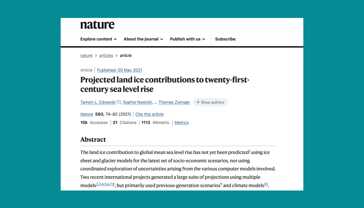
Methods:

CoCliCo regional mean sea-level projections are constructed by combining the IPCC AR6 sea-level change dataset and the GIA model outputs of Caron et al. (2018), and propagating uncertainty following a Monte Carlo approach. The regional sea-level changes therefore include the changes in ocean density and circulation, the changes due to continental glaciers and ice-sheet mass loss and their respective regional spatial distribution, changes in landwater and groundwater, and the post-glacial rebound. 

For three SSPs scenarios (i.e. SSP1-2.6, SSP2-4.5 and SSP5-8.5), the percentiles can be displayed, corresponding to the lower (17th), median (50th) and upper (83rd) bounds of the likely-range. One high-end scenario is also constructed from the 83rd percentile of the low-confidence SSP5-8.5 scenario of the IPCC AR6. High-end scenarios explore plausible – although unlikely – upper-tail sea-level scenarios beyond the likely range: i.e. when uncertainty tolerance is low and robust decision-making is preferable.    

Model Outputs:

  • Visualizations display regional sea-level changes at decadal timesteps from 2030 to 2150 with respect to the reference period 1995-2014 for three SSPs scenarios and one high-end scenario.
  • Interactive features allow scenario comparisons and data downloads for local and regional decision-making.

Limitations:

Limitations are twofold: first, vertical ground motions unrelated to the glacial isostatic adjustment are not integrated. Yet CoCliCo’s research has shown that urban areas and populations located in coastal flood plains in Europe (excluding Fennoscandia) are affected by subsidence of approximately 1mm/year in average. 

Second, sea level projections shown here have a resolution of 1°x1°, therefore not taking into account mesoscale ocean processes acting on the continental shelf and within semi-enclosed bassins such as the Mediterranean. Research undertaken by CoCliCo by ENEA and Mercator Ocean (D3.3, soon to be published) suggest that the order of magnitude of the error due to neglecting these processes can reach +/-10cm in Europe. 

7. Further Analysis 

Beside GIA, coastal regions in Europe can experience significant vertical land motion (VLM) which can be strong, robust and that can be assessed locally. There is for instance well known subsidence along the Italian Adriatic, the Netherlands or even in more localized shorelines such as the Aksiou delta next to Thessaloniki in Greece. This subsidence context can strongly inflate coastal hazards locally and should therefore be accounted for. The CoCliCo project explored local VLMs using the land vertical velocity estimates from the Copernicus European Ground Motion Service (EGMS) derived over the period 2016-2021 (Thiéblemont et al., 2024). While these estimates are not implemented in the regional sea-level projections of CoCliCo, they have been considered for the coastal hazard assessment and can be explored as an exploratory tool. 

How to use the Building Exposure User Story (#3)

“I need to see building exposure to sea level rise, now and in the future for different climate change scenarios, so I can better understand the potential risk hotspots.​”


1. What is a CoCliCo User Story?

User Stories are ready-made map datasets in the CoCliCo platform. They combine different types of important information to show scenarios for coastal risk resulting from sea-level rise,  floods and / or erosion. These layers make complex analyses easier and help users to quickly get a sense of coastal risks. 

User research showed that policymakers need clear, actionable data for flood directives, while urban planners want tools to assess local risks, and where infrastructure managers focus on long-term resilience planning. These insights helped shape User Stories to provide accessible, scenario-driven visualizations for diverse decision-making needs. There are six User Stories:

  1. Sea Level Rise Projections
  2. Inundation Distribution During a Flood Event
  3. Building Exposure
  4. Projections of Exposed People
  5. Damage Costs of Exposed Infrastructures
  6. Adaptation Based on Cost-Benefit Analysis

In this e-guideline, we walk you through the Building Exposure User Story.

2. Introduction to the Building Exposure User Story

The Building Exposure User Story in the CoCliCo platform maps the risk of coastal flooding to buildings in low-lying coastal areas under different climate scenarios. As sea levels rise and extreme weather events become more frequent, understanding which areas are most at risk is crucial for resilience planning and adaptation.

This tool combines building data from OpenStreetMap with advanced flood maps, providing policymakers, urban planners, and coastal managers with detailed insights on flood vulnerability. By highlighting localized risks, it supports evidence-based decision-making for long-term coastal adaptation.

3. Step-by-Step Platform Usage

  1. Access the CoCliCo Platform:
    1. On the left-hand menu bar, navigate to the “Exposure & Vulnerability” category, then “Building Exposure” under “User Stories”. 
  2. Select a Scenario:
    1. Choose a climate scenario (e.g., SSP1-2.6, SSP2-4.5, etc.), the percentile of the probabilistic projection (e.g. 17th, median or 83rd) and time horizon.
  3. Analyze Visualizations:
    1. Use interactive tools to zoom into regions and access localized insights.
    2. Use the “Add to Dashboard” feature to retain charts and graphs for further comparison and analysis
    3. Toggle on other layers, such as “natural hazards” and “exposure & vulnerability,” for more context on the impacts and risks faced by that area. For simpler comparisons, make sure you add your charts and graphs to your dashboard to compare across time and geographies and observe various layers and user stories of that area. 
  4. Further Analysis:
    1. Export maps or raw datasets for further analysis in the Workbench or other GIS tools​​.
    2. Assess local projections with vertical land motion (VLM) using our coastal hazard assessment.

4. Target Users & Intended Use

Target Users:

  • Policymakers implementing national and EU flood directives.
  • Urban planners and city authorities in coastal areas.
  • Infrastructure managers addressing coastal resilience.
  • Researchers and consultants assessing coastal risks.

Intended Use:
The layer provides simplified, robust visualizations for identifying building exposure from sea-level rise. It supports broad-scale assessments, preliminary decision-making, and compliance with policies like the European Flood Directive.

Key Benefits:

  • Enables informed risk assessments and adaptation planning at all scales (national to municipal).
  • Improves stakeholder engagement with clear, accessible data.
  • Aids investment prioritization and strategic land-use decisions.

5. Example of Use 

“Using the Building Exposure User Stories, city planners identified their neighbourhoods as having a higher risk of flooding related to sea level rise by 2050 under high-emission scenarios high-emission scenarios compared to other neighbourhoods in the country.

6. Data, Methods, and Model Overview

Data Sources:

The building exposure is based on the latest building information extracted from OpenStreetMap. OpenStreetMap provides a consistent data layer across Europe, with standardized information on building type and location. 

Methods:

The building footprints extracted from OpenStreetMap are combined with CoCliCo’s state-of-the-art inundation maps.

Model Outputs:

  • Visualizations display building exposure at decadal timesteps from 2030 to 2150 for three SSPs scenarios and one high-end scenario.
  • Interactive features allow scenario comparisons and data downloads for local and regional decision-making.

Limitations:

While OpenStreetMap provides a consistent coverage across Europe, it does not provide a complete coverage. Across Europe, the average completeness is estimated to be roughly 70%. Some countries have integrated national-scale databases within OpenStreetMap (e.g. The Netherlands, France & Italy) and are therefore almost complete, other countries have very active user communities that aim for a near-complete data (e.g., Germany). However, some countries still experience several gaps (e.g., Ireland and the United Kingdom). Given the potential of missed buildings, we advise local authorities to careful check, and if possible to re-run the analysis with local information before any decisions are made.

7. Further Analysis 

The building exposure layer is the starting point for the coastal risk assessment [link here to the Buildings at risk of flood and erosion user story]. Moreover, within the workbench one can extract exposure data for their area of preference, allowing to better understand how sea-level rise will increase future coastal flood risk within any coastal area across Europe.

How to use the Projections of Exposed People User Story (#4)

“I need information of the development of exposed population in the future for different combinations of climate and socioeconomic scenarios on a regional to national scale, so I can preliminary assess exposure to coastal flooding.”


1. What is a CoCliCo User Story?

User Stories are ready-made map datasets in the CoCliCo platform. They combine different types of important information to show scenarios for coastal risk resulting from sea-level rise,  floods and / or erosion. These layers make complex analyses easier and help users to quickly get a sense of coastal risks. 

User research showed that policymakers need clear, actionable data for flood directives, while urban planners want tools to assess local risks, and where infrastructure managers focus on long-term resilience planning. These insights helped shape User Stories to provide accessible, scenario-driven visualizations for diverse decision-making needs. There are six User Stories:

  1. Sea Level Rise Projections
  2. Inundation Distribution During a Flood Event
  3. Building Exposure
  4. Projections of Exposed People
  5. Damage Costs of Exposed Infrastructures
  6. Adaptation Based on Cost-Benefit Analysis

In this e-guideline, we walk you through the Projections of Exposed People User Story.

2. Introduction to the Projections of Exposed People User Story

The Projections of Exposed People User Story in the CoCliCo platform shows how many people may be affected by coastal flooding in the future. It combines high-resolution flood and projected population data to provide clear insights under different climate and socioeconomic scenarios.

Since future population growth and movement are uncertain, this tool considers multiple scenarios of population development to improve flood risk assessments. By mapping projected population exposure to coastal flooding at a high spatial scale, it helps policymakers, urban planners, and resilience experts make informed decisions for adaptation and risk reduction.

3. Step-by-Step Platform Usage

  1. Access the CoCliCo Platform:
    1. On the left-hand menu bar, navigate to the “Exposure & Vulnerability” category, then “Projections of Exposed People” under “User Stories”. 
  2. Select a Scenario:
    1. Choose a climate scenario (e.g., SSP1-2.6, SSP2-4.5, etc.), the percentile of the probabilistic projection (e.g. 17th, median or 83rd) and time horizon.
  3. Analyze Visualizations:
    1. Use interactive tools to zoom into regions and access localized insights.
    2. Use the “Add to Dashboard” feature to retain charts and graphs for further comparison and analysis
    3. Toggle on other layers, such as “natural hazards” and “exposure & vulnerability,” for more context on the impacts and risks faced by that area. For simpler comparisons, make sure you add your charts and graphs to your dashboard to compare across time and geographies and observe various layers and user stories of that area. 
  4. Further Analysis:
    1. Export maps or raw datasets for further analysis in the Workbench or other GIS tools​​.
    2. Assess local projections with vertical land motion (VLM) using our coastal hazard assessment.

4. Target Users & Intended Use

Target Users:

  • Policymakers implementing regional, national and EU flood directives.
  • Urban planners and city authorities in coastal areas.
  • Researchers and consultants assessing coastal population exposure.

Intended Use:
The layer provides simplified, robust visualizations for identifying areas of high population exposure to coastal flooding. It supports broad scale, as well as localised exposure assessments to enable preliminary risk assessments and adaptation planning.

Key Benefits:

  • Enables informed exposure assessments and adaptation planning at all scales (national to municipal).
  • Improves stakeholder engagement with clear, accessible data.
  • Aids investment prioritization and strategic land-use decisions.

5. Example of Use 

“Using the exposed population projections User Story, local authorities identified a concentration of population exposure in a specific area by 2050 under a high sea level scenario and low defence level. This analysis initiated a systematic and targeted adaptation planning process in this area, focusing on enhancing defences to eliminate the population exposure.”

6. Data, Methods, and Model Overview

Data Sources:

CoCliCo’s population projections use IIASA data, downscaled with historical trends and spatial factors like roads, urban areas, and coastline proximity. Areas unsuitable for development, such as steep slopes, water-covered regions, and protected areas, are excluded. These projections are combined with CoCliCo flood data to assess population exposure to coastal flooding.

  • Based on national population and urbanization projections from IIASA 
  • Downscaled and spatially distributed using historic population data (GHS-POP) 

Projections account for key geographic and infrastructural influences. Distance to: 

  • Roads (OSM data
  • Urban areas (defined by population density, Degree of Urbanization method
  • Coastline (MERIT DEM coastal mask
  • Urban centres (travel time model by Weiss et al., 2018

Excluded from future population growth 

  • High elevation or steep slopes (MERIT DEM
  • Permanently flooded areas (Corine Land Cover
  • Protected areas (World Database on Protected Areas

Methods:

CoCliCo’s population projections are created by extending the model of Reimann et al. (2021) that helps distribute updated national population data from IIASA (2010–2100) in 10-year intervals. The data is broken down at a 1 km resolution for EU countries and the UK, for different Shared Socioeconomic Pathways (SSPs). 

The model works by first calculating the “potential” or attractiveness of each area (or grid cell). It then distributes national population changes over time based on this potential. The “potential” of an area is influenced by factors like how close it is to nearby areas, population density, and distance from the coastline. The model also considers past patterns of people moving between coastal/inland and urban/rural areas, adjusting for two time periods. In addition, urbanization projections are used to account for the different ways urban and rural areas develop over time in each SSP. 

These population projections are combined with flood projections based on the integrated climate and socioeconomic scenarios to assess how many people are exposed to coastal flooding. The population and flood projections are aligned to ensure they match in both projection and resolution, allowing for accurate calculation of exposed populations at the Local Administrative Units (LAUs) level in coastal areas. These results are then summarized at smaller spatial levels. 

Model Outputs:

  • Visualizations display gridded population projections for the years 2010, 2030, 2050 and 2100 for five integrated scenarios (No SLR-SSP2, SSP1-2.6, SSP2-4.5, SSP5-8.5 and one high-end scenario with SSP5). 
  • Interactive features allow scenario comparisons and data downloads for local to national decision-making. 

Limitations of Population Projections 

  • Population Decline: In areas with population decline, the model treats cell potential differently. In urban areas, higher cell potential is linked to population loss due to suburbanization. In rural areas, lower cell potential is associated with higher population loss. This is a general assumption and might not apply to all EU regions. 
  • Urban and Rural Definitions: Urban and rural areas are redefined after each timestep based on urbanization share. However, this measure only reflects the fraction of the population living in urban areas and doesn’t capture the complex structure of urban regions. 

Limitations of Exposed Population 

  • Data Alignment: To combine flood and population projections, both need to have the same resolution and projection. We adjust the population data to match the flood projections, but this can affect population counts. 
  • Coastline Differences: The population and flood projections use different coastlines, so some people living near the coast might not be considered exposed, even if they are on the ocean side of the coastline. 

7. Further Analysis 

To account for the full range of uncertainty in population development and its impact on coastal flooding, it’s useful to explore other socioeconomic scenarios beyond the integrated ones. While these additional estimates aren’t included directly in the platform, they can be explored in the workbench by combining various climate and socioeconomic scenarios at different spatial scales. 

How to use the Damage Costs of Exposed Infrastructures User Story (#5)

“I need to quantify damage costs of infrastructures exposed to flooding and assess how it evolves under different climate change scenarios”


1. What is a CoCliCo User Story?

User Stories are ready-made map datasets in the CoCliCo platform. They combine different types of important information to show scenarios for coastal risk resulting from sea-level rise,  floods and / or erosion. These layers make complex analyses easier and help users to quickly get a sense of coastal risks. 

User research showed that policymakers need clear, actionable data for flood directives, while urban planners want tools to assess local risks, and where infrastructure managers focus on long-term resilience planning. These insights helped shape User Stories to provide accessible, scenario-driven visualizations for diverse decision-making needs. There are six User Stories:

  1. Sea Level Rise Projections
  2. Inundation Distribution During a Flood Event
  3. Building Exposure
  4. Projections of Exposed People
  5. Damage Costs of Exposed Infrastructures
  6. Adaptation Based on Cost-Benefit Analysis

In this e-guideline, we walk you through the Damage Costs of Exposed Infrastructures User Story.

2. Introduction to the Damage Costs of Exposed Infrastructures User Story

The User Story on Damage Costs for Exposed Infrastructures in the CoCliCo platform aims at presenting the direct economical impacts of coastal flooding under different climate scenarios. While many coastal infrastructures are protected today, rising sea levels will increase flood extent and depth, leading to higher damage costs without further adaptation. 

This tool helps policymakers and planners assess these costs at national, regional, and local levels in order to inform adaptation strategies. It combines the latest sea level projections, European flood hazard data, and infrastructure inventories to provide city-scale estimates of future flood damage. 

3. Step-by-Step Platform Usage

  1. Access the CoCliCo Platform:
    1. On the left-hand menu bar, navigate to the “Exposure & Vulnerability” category, then “Damage Costs of Exposed Infrastructures” under “User Stories”. 
  2. Select a Scenario:
    1. Choose a climate scenario (e.g., SSP1-2.6, SSP2-4.5, etc.), the percentile of the probabilistic projection (e.g. 17th, median or 83rd) and time horizon.
  3. Analyze Visualizations:
    1. Use interactive tools to zoom into regions and access localized insights.
    2. Use the “Add to Dashboard” feature to retain charts and graphs for further comparison and analysis
    3. Toggle on other layers, such as “natural hazards” and “exposure & vulnerability,” for more context on the impacts and risks faced by that area. For simpler comparisons, make sure you add your charts and graphs to your dashboard to compare across time and geographies and observe various layers and user stories of that area. 
  4. Further Analysis:
    1. Export maps or raw datasets for further analysis in the Workbench or other GIS tools​​.
    2. Assess local projections with vertical land motion (VLM) using our coastal hazard assessment.

4. Target Users & Intended Use

Target Users:

  • Policymakers implementing national and EU flood directives.
  • European, national and regional policy makers assessing needs for adaptation and to handle losses and damages.
  • Urban planners and city authorities in coastal areas assessing future risks.
  • Infrastructure management assessing risks in the immediate surrounding of their facilities
  • Researchers and consultants assessing coastal risks.

Intended Use:
The layer provides simplified, robust visualizations to identify coastal risks due to flooding in the context of sea-level rise. It supports broad-scale assessments, preliminary decision-making, and compliance with policies like the European Flood Directive.

Key Benefits:

  • Enables informed decisions based assessments of risks, and not only hazards and exposure (national to municipal).
  • Improves stakeholder engagement with clear, accessible data.
  • Aids investment prioritization and strategic land-use decisions.

5. Example of Use 

National policy makers used the damage costs estimates to get a first order estimate of costs in regions and municipalities and prioritize on adaptation actions and investments in order to maximize the efficiency of public investments in adaptation. While this information can not be used as a single source of information to guide adaptation investments, it provides an element that can be considered together with additional evidence and selection criteria of decision makers”

“The damage costs estimates at municipal level have been used to identify the potential damage costs in a particular flood plain, allowing to anticipate to what extent existing compensation mechanisms (e.g. insurance) are adequately designed to address loss and damages a now and in the future”

6. Data, Methods, and Model Overview

Data Sources:

Damage costs on infrastructures are calculated by crossing hazard, buildings and vulnerability curves.

  • Hazards: Flood maps (water depth) calculated either with or without defences from the CoCliCo project (data producer: IH-Cantabria; available on the CoCliCo STAC Catalog). Flood maps are provided for hindcast, 2030, 2050, 2100 and 2150 for permanent flooding, 1-yr, 100-yr and 1000-yr return period with various SLR scenarios. 
  • Exposure: Coastal European Exposure Database (data producer: Institute for Environmental Studies, Vrije Universiteit Amsterdam, available on the CoCliCo STAC Catalog). 11 classes of infrastructures are considered: Building, Power, Wastewater, Telecom, Oil, Gaz, Education, Healthcare, Rail, Road and Water. Infrastructures can be represented as points, lines, polygons or multipolygons. 
  • Vulnerability curves: Physical Vulnerability Database for Critical Infrastructure Hazard Risk Assessments. (data producer: Institute for Environmental Studies, Vrije Universiteit Amsterdam, Dataset: Physical Vulnerability Database for Critical Infrastructure Hazard Risk Assessments).The data comes from a study that compiles most of the existing vulnerability curves found in the literature, along with the associated cost. It consists of 102 different vulnerability curves, which depend on the type of infrastructure, and 179 different cost values. The vulnerability curves are used to characterize the percentage of damage to infrastructure based on water height. 

Methods:

The damage costs are calculated by intersecting hazard (raster) and exposure (polygons) data layers, and vulnerability curves. First, we overlay the coastal flood hazard map with infrastructure data to obtain an average water height for each infrastructure. Then, based on the category of the infrastructure, we apply the corresponding vulnerability curves (e.g. healthcare, education, railway, etc).

For the CoCliCo project, we used 18 different vulnerability curves. Once the damage is determined, the associated cost calculation is carried out: the damage cost is the product of the building’s surface area, the percentage of damage, and the maximum damage, based on construction costs.

Model Outputs:

  • Potential costs can be visualized in different ways: through a map that displays a color gradient based on the total damage cost for each LAU (Local Administrative Unit) across all infrastructures. To do this, the user selects the type of defense, the desired SSP scenario, the time horizon and the return period. The user can also view more details by clicking on a specific LAU. In this case, they can select the defense level, return period, and the category of infrastructure they are interested in. A graph will appear showing the evolution of costs over time, based on the different SSP scenarios.
  • Importantly, the costs presented here are the costs associated to a particular return period. It neither corresponds to the costs associated to a particular event that would affect a specific region, nor to an expected annual damage value that would integrate costs of various return periods.

Limitations

One of the main limitations of this method lies in the assumption that infrastructures remain unchanged over time, without considering any construction or destruction of infrastructure. Additionally, the lack of detailed information on certain infrastructures can affect the accuracy of selecting the vulnerability curve, which may lead to variations in the estimated cost. Similarly, the price used is an average price that does not account for specific factors such as the location of the damage or the current local construction costs.

/

How to use the Adaptation Based on Cost-Benefit Analysis User Story (#6)

“I want to see economically optimal coastal adaptation options both today and, in the future, as well as the expected investments in coastal adaptation and the potential costs of flood damages.”


1. What is a CoCliCo User Story?

User Stories are ready-made map datasets in the CoCliCo platform. They combine different types of important information to show scenarios for coastal risk resulting from sea-level rise,  floods and / or erosion. These layers make complex analyses easier and help users to quickly get a sense of coastal risks. 

User research showed that policymakers need clear, actionable data for flood directives, while urban planners want tools to assess local risks, and where infrastructure managers focus on long-term resilience planning. These insights helped shape User Stories to provide accessible, scenario-driven visualizations for diverse decision-making needs. There are six User Stories:

  1. Sea Level Rise Projections
  2. Inundation Distribution During a Flood Event
  3. Building Exposure
  4. Projections of Exposed People
  5. Damage Costs of Exposed Infrastructures
  6. Adaptation Based on Cost-Benefit Analysis

In this e-guideline, we walk you through the Adaptation Based on Cost-benefit Analysis User Story.

2. Introduction to the Adaptation Based on Cost-benefit Analysis User Story

The Adaptation Based on Cost-Benefit Analysis User Story in the CoCliCo platform helps identify the most cost-effective ways to manage coastal flood risks under different climate scenarios. It evaluates three key adaptation strategies:

  • Protection – Building coastal defences like seawalls or restoring dune fields.
  • Retreat – Relocating people and assets away from flood zones.
  • Accommodation – Flood-proofing buildings to withstand extreme events.

The platform provides country-level insights on the best mix of these strategies, with more detailed local assessments available through the workbench. This helps policymakers and planners make informed, cost-effective adaptation decisions.

3. Step-by-Step Platform Usage

  1. Access the CoCliCo Platform:
    1. On the left-hand menu bar, navigate to the “Risk & Adaptation” category, then “Cost-benefit analysis of coastal adaptation” under “User Stories”. 
  2. Select a Scenario:
    1. Choose a climate scenario (e.g., SSP1-2.6, SSP2-4.5, etc.), time horizon and adaptation strategy.
  3. Analyze Visualizations:
    1. Use interactive tools to zoom into regions and access localized insights.
    2. Use the “Add to Dashboard” feature to retain charts and graphs for further comparison and analysis
    3. Toggle on other layers, such as “natural hazards” and “exposure & vulnerability,” for more context on the impacts and risks faced by that area. For simpler comparisons, make sure you add your charts and graphs to your dashboard to compare across time and geographies and observe various layers and user stories of that area. 
  4. Further Analysis:
    1. Export maps or raw datasets for further analysis in the Workbench or other GIS tools​​.
    2. Assess local projections with vertical land motion (VLM) using our coastal hazard assessment.

4. Target Users & Intended Use

Target Users:

  • Policymakers implementing national and EU flood directives.
  • Urban planners and city authorities in coastal areas.
  • Researchers and consultants assessing the economics of coastal impacts.

Intended Use:
This User Story provides an overview of the most cost-efficient adaptation options at the country level, helping with broad decision-making. For more detailed insights, local coastal floodplain analyses available in the workbench can support more specific, local decisions.

The analysis aims to kickstart discussions about coastal adaptation strategies, identify areas where doing nothing would be costly, and offer initial suggestions for adaptation options and their timing. However, a more detailed local assessment should follow since the continental-scale analysis here doesn’t include the finer details that could affect the suitability of adaptation options for specific locations.

Key Benefits:

  • Enables informed adaptation planning at all scales (national to municipal).
  • Gives justification for coastal adaptation investments and strategic land-use decisions.

5. Example of use 

“National policymakers identified that significant funding would be required to address coastal flood risks in various regions. They allocated funding for coastal adaptation, encouraging local authorities to conduct their own research. This approach allowed local governments to assess specific risks and develop tailored solutions, ensuring more effective, region-specific adaptation strategies.”

6. Data, Methods, and Model Overview

Data Sources:

Regional median sea-level projections, excepted vertical land motions (VLMs), costs for adaptation investments and current protection levels in Europe are from other deliverbales/workpackages in CoCliCo. Extreme return periods are from COAST-RP (Dullaart e al. 2021). We model hypsometric profiles for each coastal floodplain based on the Copernicus digital elevation model (DEM) and population data from the Global Human Settlement Layer.

Methods:

The cost-benefit optimisation integrates several components:

  • A hazard component to model extreme sea level
  • An exposure component to assess population and assets at risk
  • A vulnerability component to assess the susceptibility of assets to hazards
  • An adaptation state space to outline potential adaptation pathways
  • Cost functions to estimate the costs associated with adaptation actions

The multi-stage cost-benefit optimisation is conducted for each of the 41,327 coastal floodplains individually. We consider a time horizon from 2020 to 2150 with 10-year time steps, a discount rate of 3% and three greenhouse gas emission scenarios: low emissions (SSP1-2.6), high emissions (SSP2-4.5) and very high emissions (SSP5-8.5).

Model Outputs:

  • For each coastal floodplain, the model determines the economically optimal adaptation pathway, which is a sequence of adaptation options over time. These adaptation pathways can be further explored through the workbench.
  • The web viewer illustrates the proportion of the coastline where each adaptation option is economically optimal by 2150 for each country, based on the economically optimal coastal adaptation pathways for all 41,327 floodplains.

Limitations

This cost-benefit model uses broad data to manage computational limits, which means it doesn’t include detailed information about properties, land use, or infrastructure. As a result, the model may be less accurate for specific floodplains. For example, it might suggest retreat as the best adaptation option for an area with a nuclear power plant, but this could present major challenges that the model doesn’t account for.

The model also only considers the median sea-level rise (SLR), leaving out high-end SLR scenarios. A sensitivity analysis showed that uncertainties in factors like the discount rate, protection and retreat costs, and protection levels have a bigger impact on the choice of adaptation options, the timing of actions, and total costs than the climate change scenarios themselves.

7. Further Analysis 

Technical users can use the Workbench to perform detailed, localised analyses by adjusting variables like flood risks, cost factors, and adaptation options. This allows for tailored assessments of the most cost-effective strategies and the timing of actions at the local scale.

Users can explore different sea-level rise scenarios, test adaptation measures, and incorporate local data such as infrastructure details to refine their analysis. The Workbench enables deeper insights, helping inform more precise local adaptation strategies.

Understanding Sea Level Rise Projections and the Role of Scenarios 

The 21st century has witnessed an unprecedented rise in global mean sea level (GMSL), a trend that is projected to continue till at least 2100. The Intergovernmental Panel on Climate Change (IPCC) reports that GMSL rose faster in the 20th century than in any prior century over the last three millennia. The rise has been attributed to ocean thermal expansion and mass loss from glaciers and ice sheets, with minor contributions from changes in land-water storage. 

However, these projections come with a degree of uncertainty. The future sea level rise could be influenced by earlier-than-projected disintegration of marine ice shelves, abrupt onset of marine ice sheet instability, and faster-than-projected changes in the surface mass balance and discharge from Greenland. These processes are characterized by deep uncertainty due to limited process understanding, limited availability of evaluation data, uncertainties in their external forcing, and high sensitivity to uncertain boundary conditions and parameters. 

Why Do We Use Scenarios in Climate Change Science for Projections?

Scenarios are used in climate change science to understand the potential future impacts of climate change. They provide a structured way to explore and communicate complex, uncertain future conditions. In the context of climate change, scenarios are not predictions or forecasts, but rather plausible descriptions of how the future might evolve. 

What are Shared Socioeconomic Pathways (SSPs)? 

Shared Socioeconomic Pathways (SSPs) are scenarios used by climate researchers to project the potential future states of societies and economies. They consider various factors like population growth, economic development, education, urbanization, and the rate of technological change. The IPCC has defined five SSPs, each representing a different trajectory for societal development in the absence of climate policy intervention and a different level of challenges to mitigation and adaptation. 

How are SSPs related to Sea Level Rise and Coastal Management? 

SSPs play a crucial role in understanding the potential impacts of sea level rise and formulating effective coastal management strategies. They help us understand how different societal pathways might influence greenhouse gas emissions, which in turn drive global warming and sea level rise. By understanding these potential future states, we can better plan for and manage the risks associated with sea level rise. 

Sea Level Rise on each SSP in Europe 

Each SSP represents a different potential future, and thus, a different potential impact from sea level rise. For instance, under SSP1-1.9, where warming is held to approximately 1.5°C above 1850-1900 levels by 2100, the projected sea level rise is lower compared to SSP5-8.5, a high reference scenario with no additional climate policy, where emission levels are highest. 

In Europe, as in the rest of the world, the impact of sea level rise will vary significantly depending on the SSP. Coastal areas will face increased risks from flooding, erosion, and other coastal hazards. The ability of these areas to adapt to these changes will depend on a variety of factors, including the rate of sea level rise, the physical characteristics of the coast, and the societal and economic pathway followed. 

In conclusion, understanding and considering SSPs is crucial in our fight against climate change. They provide us with a framework to understand potential future societal and economic conditions, helping us prepare for and mitigate the impacts of sea level rise. As we continue to refine these pathways and our understanding of their implications, they will remain an essential tool in our climate change arsenal. 

Explore More:

Webinar Recording: IPCC Projections & Sea Level Rise

During this webinar, authors from working groups I and II from the 2022 IPCC report presented the data, where to find it and how to interpret it, and how practitioners can understand low-likelihood/high-impact sea-level rise projections and their use in adaptation. The event concluded with a presentation of the joint policy brief from European Projects PROTECT, CoCliCo and SCORE, “When will a 2-metre rise in sea level occur, and how might we adapt?”

Speakers: Bob Kopp from Rutgers UniversityMarjolijn Haasnoot from Deltares and Utrecht UniversityKarina VON SCHUCKMANN from Mercator Ocean InternationalGonéri Le Cozannet from BRGMRoshanka Ranasinghe from Deltares, IHE Delft Institute for Water Education and University of Twente, Gaël Durand, Robert Nicholls from University of East AngliaA K M Saiful Islam from Drexel University,and Elham Ali from Suez University(TBC).

The policy brief: https://protect-slr.eu/policy-briefs/ 

Watch the webinar now: https://youtu.be/yoHCInbj2ok

IPCC Projections & Sea Level Rise

Want to know more about the IPCC projections & planning for sea level rise

This event will present key statements on the sea-level rise from the Working Group I and II IPCC reports, including adaptation challenges. The authors of the report will present the latest projections, where to find the data and how to interpret it, and how practitioners can understand low-likelihood/high-impact sea-level rise projections and their use in adaptation. The event will conclude with the presentation of the joint policy brief from European Projects PROTECT, CoCliCo and SCORE, “When will a 2-metre rise in sea level occur, and how might we adapt?”

This event will be particularly useful for people working in coastal adaptation, integrated coastal zone management or at the interface between science and society, from journalists to science communicators.

PROTECT webinar: Monday 30 January – 3-5 pm CET

Speakers: Bob Kopp from Rutgers UniversityMarjolijn Haasnoot from Deltares and Utrecht UniversityKarina VON SCHUCKMANN from Mercator Ocean InternationalGonéri Le Cozannet from BRGMRoshanka Ranasinghe from Deltares, IHE Delft Institute for Water Education and University of Twente, Gaël Durand, Robert Nicholls from University of East AngliaA K M Saiful Islam from Drexel University,and Elham Ali from Suez University(TBC).

This event is free by registering in advance:

If you know someone working on sea level rise and coastal risk, tag them in the comments! It’s likely this event will be of interest to them. 

Information on the event: https://lnkd.in/ect–Aq6 

The policy brief: https://protect-slr.eu/policy-briefs/ 

IPCC WG2 Climate Report

The IPCC WG2 Climate Report published today is the most precise and up to date global assessment of impacts, vulnerability and adaptation to climate change available at this time.  270 authors from 67 countries contributed to this assessment. 

Sea level rise represents a major threat for coastal communities, infrastructure and ecosystems during the 21st century and beyond. Thus, adaptation to sea level rise is one of the challenges addressed in this report. 

The sea-level projections delivered in July 2021 by WG1 are a major step forward. These projections are extended from 2100 to 2150 and they provide a quantitative estimate of a low-likelihood / high impact sea-level rise involving large ice mass losses in Antarctica and Greenland. Our sister project Protect Slr contributed to this assessment through new projections of ice mass losses.

Authoritative climate services will be needed to support adaptation: CoCliCo Services aims at developing a core service for coastal adaptation to sea level rise in Europe, in close cooperation with Copernicus Marine Service.

Adaptation alone will not be sufficient: urgent mitigation of climate change is needed to reduce sea level rise rates and give more time for adaptation planning and implementation, as well as to coastal ecosystems to migrate landward.